The wind shows us how close to the edge we are

(Joan Didion, Los Angeles Notebook, 1968)

The wreck of the Adgillus

The wreck of the Adgillus, a 415-ton wooden barque that foundered on 21st October 1874 en route from Liverpool to the west coast of Africa, lies 50 nautical miles NNW of Liverpool. [1]

Given that the usual shipping route to West Africa would be south out of Liverpool, why this seemingly unusual location?

Map highlighting the route from Liverpool to West Africa using dark yellow dots as reported by shipping in various locations: it shows that ships just did not round the northern tip of Ireland but proceeded due south in the Irish Sea and out into the Atlantic
The usual route for sailing ships heading from Liverpool to West Africa.
Map generated using data from the Climatological Database for the World’s Oceans 1750–1854 (CLIWOC, https://historicalclimatology.com/cliwoc) and from  https://www.openstreetmap.org/copyright

Here we explore the materiality of an encounter with the wind, through the loss of Adgillus in 1874. 

October 1874: Adgillus is in Queen’s Dock, Liverpool, loading a general cargo of salt, gunpowder, household ceramics and clay pipes [2] Bound for ‘Old Calabar’ (now Calabar, capital of Cross River State, Nigeria) this will be her second such voyage, and only her third altogether. There’s a story to be told in the trade of manufactured goods from Britain for palm oil from west Africa [3] but for this blog, at least, we’ll continue to follow the wind.

Built in 1873 by Oliver, Québec, under special survey, her sale notice describes this ‘beautiful new barque’ as 143 3/10 feet in length, diagonally iron strapped and entirely metal fastened, with double topsail yards, and patent pumps and windlass, “one of the best finished ships ever built in the colonies”. [4] It also notes she’s fast, sailing from Quebec loaded with grain in just 22 days.

Adgillus changes hands via shipbroker CW Kellock and Co, passing to new owners T Harrison & Co of Liverpool by the end of March 1874 [5] at a cost of £16 a ton. [6] Fitted out for another £1000, Adgillus completes her first voyage to Old Calabar, sailing from Liverpool April 5, arriving by July 18, and returning to Liverpool by 21 September the same year. [7]

It must have been a lucrative venture as her owners plan a second voyage for October 1874, though with a last minute change of Master, from a Mr Brett to a Mr A. Thompson. On the 20th, on 6am high tide and with a fresh SSW wind, Adgillus leaves Liverpool for the second time. [8]

Towed by a tug to the North-West Lightship, NW of Liverpool, the intention is to set the pilot ashore at Point Lynas, Anglesey, before continuing south to Calabar. [9]

Adgillus can be seen to the north of Liverpool (lower right of image, captioned NW Lightship) and to the south-east of the Isle of Man (to upper right of image).
Map showing the location of the North West Lighship, where Adgillus was left by a tug on the night of the 20th October 1874; Port Lynas, where the pilot was to be set ashore, and the the final location of the wreck of Adgillus. Under normal circumstances she would have proceeded south after landing the pilot
Map data from https://www.openstreetmap.org/copyright.

The weather for the preceding week has been good, and at 8am the wind is set fair for Adgillus’ passage at SW force 3. The predicted WNW force 5 wind would have been better, but has not materialised. Instead, something completely unexpected happens. As the Met Office weekly summary for October 18-24 1874 states: “even the readings at 6pm showed no indication of what was approaching.” [10]

A hurricane is coming, the worst storm to hit the British Isles since the great storm of January 1866 in which at Torbay alone 40 vessels and over 70 sailors were lost [11],  and Adgillus is about to sail right into it.

Adgillus is still in the vicinity of the North-West Lightship. Around midnight a strong and increasing breeze sets in, blowing from the northwest. Reducing the sails can’t stop the foresail blowing away at around 3am; at 4am the foretopmast-staysail is ripped away too, followed shortly by the mizzen staysail. [12]

The sea starts breaking over the vessel and by 8am a hurricane is blowing from the WSW: Adgillus is helpless with her lee (opposite the wind) side underwater, demonstrating how forcefully the wind is pushing her over. The crew manage to right her, but her patent pumps are now found to be full of water.

In a final attempt to save her, the crew discharge the cargo, but it’s no use and at 2pm she begins to founder. The crew rush to the longboat, now floating from the deck, and all but one make it on board: Antoine Natal, from Malacca, is caught in the rigging and goes down with the ship. [13]

By ‘drugging’ the long boat the crew manage to keep her bows on to the incoming waves and nine hours later, despite the ‘terrific’ sea, Captain Thompson, First Officer Richard Jones; Second Officer Thompson; Pilot William Parry; Carpenter David Robinson and the 12 remaining crew make it safely to Morecambe Bay Lightship. [14]

Though Adgillus has been lost, the master, officers and crew have been luckier than many at sea that night. The inquiry, held the following month, commends the captain and the loss is attributed solely to the ‘force of the gale’, or, as one of the witnesses put it in the usual language of the time, ‘stress of weather’. [15]

The inquiry into the loss gives the sinking position as ‘about 18 miles NW of Morecambe Bay Light Vessel’ (in 1991 recovery of her bell would confirm her position as 54.04722N 003.80764W). In the 14 hours wrestling with the storm the crew had been blown over 50 miles off course. [16]

Wind direction, force and speed are critical factors not only in explaining how shipwrecks occur, but where they end up – whether off course at sea, or forced ashore in a specific location on land (See our earlier blog Sea Adventure for the effects of the wind just north-west of the Wash on the opposite coast of England.)

For sailing vessels, the wind that filled the sails could transform into a terrifying mechanism of destruction at any moment, particularly at a time when weather forecasting was less accurate than it is now.

A dramatic seascape featuring a tall ship battling strong waves under a stormy sky, lit by a gap in the clouds above, but surrounded by dark clouds and a small boat which has also lost its sails  in the troughs of the waves to the left.
A Ship on the High Seas Caught by a Squall, known as The Gust Willem van de Velde (II) c.1680 is a depiction of a British warship in distress in a gale, with a sail blown out, showing us the wind direction, and heeling under the onslaught. The small sailing vessel to left has also lost her sails. This painting by one of the major marine artists of the 17th century, illustrates the forces with which seamen had to contend during the Age of Sail: some are climbing the rigging at imminent peril of their lives.
© Rijksmuseum, Amsterdam SK-A-1848

The wind still powers Britain’s maritime interests, which have undergone a transformation – from harnessing the power of the wind as a dominant naval and trading power during the Age of Sail, to harnessing the power of the wind to become a leading player in the offshore renewable energy sector in this era of climate change.

This week’s guest article comes courtesy of the Marine Data Exchange Heritage Accelerator (MDEHA), led by Historic England and is the result of a collaboration between Lara Band, Marine Data Analyst (MDEHA), and Serena Cant, Maritime Research Specialist.

By redeploying marine development data into The Crown Estate’s Marine Data Exchange and Historic England’s Marine Historic Environment Record (MHER), MDEHA is making high‑quality heritage information available to support strategic planning for offshore wind and contribute to cleaner energy delivery. In this ongoing cycle of wind shaping both past losses and present and future energy needs, today’s harnessing of wind to mitigate climate‑driven change in turn generates new data that can help conserve sailing ships lost through earlier storms. This data can help to bring to life stories of losses at sea like this one, adding context to the remains that survive on the seabed. MDEHA forms part of the Offshore Wind Evidence and Change (OWEC) programme, led by The Crown Estate in partnership with the Department for Energy Security and Net Zero (DESNZ) and Department for Environment, Food & Rural Affairs (DEFRA).

Footnotes:

[1] See Adgillus    https://historicengland.org.uk/listing/heritage-gateway/results/record/0d636742-8028-4a8c-8b7c-e1f9aaf2d338/0429bdbb-9d14-445a-ad43-e20dbeb8b636

[2] Ibid.; Liverpool Shipping Telegraph and Daily Commercial Advertiser, 11 November 1874, p4

[3] Samuel, I. 2026. ‘The Oil Economies of Pre-colonial West Africa: Palm Oil and the Industrial Revolution (1800-1891)’ https://www.africanhistoryextra.com/p/the-oil-economies-of-pre-colonial

[4] Liverpool Journal of Commerce, 27 December 1873, p8

[5] Liverpool Journal of Commerce 21 March 1874, p7; Shipping and Mercantile Gazette, 26 March 1874, p4

[6] Lancaster Gazette, 14 November 1874, p2

[7] Liverpool Journal of Commerce, 7 April 1874, p5; Liverpool Shipping Telegraph and Daily Commercial Advertiser, 18 July 1874, p4; Daily Telegraph & Courier (London), 22 September 1874, p6

[8] Lancaster Gazette, 14 November 1874, p2;  Liverpool Shipping Telegraph and Daily Commercial Advertiser, 20 October 1874, p1; Meteorological Office Daily Weather Reports 1st July – 31st December 1874, 20 October https://digital.nmla.metoffice.gov.uk/IO_f5bd9ddb-b885-4edb-ae77-7c5890960bb7/

[9] Lancaster Gazette, 14 November 1874, p2

[10] Meteorological Office Daily Weather Reports 1st July – 31st December 1874, Summary of weather in western Europe from Oct 18th to Oct 24th 1874 https://digital.nmla.metoffice.gov.uk/IO_f5bd9ddb-b885-4edb-ae77-7c5890960bb7/

[11] Daily Telegraph & Courier (London), 22 October 1874, p3; ‘The wrecks in Torbay during the gales of the 10th and 11th January, 1866’ The Lifeboat: Journal of the National Life-boat Institution Vol VI, No 61 2 July 1866, p191. Of these wrecks 41 are noted in the records of Historic England.

[12] Lancaster Gazette, 14 November 1874, p2

[13] ibid.; Hull Daily News, 31 October 1874, p7

[14] ibid.

[15] London Evening Standard, 13 November 1874, p2

[16] ibid; Lancaster Gazette, 14 November 1874; estimate of 50 miles off course based on data from the Lancaster Gazette and the record for Adgillus held by Historic England (see note 1)

Jolani: from Chance Purchase to Community Enterprise

The Story of a Swedish barque wrecked off Berwick-upon-Tweed in 1916

Modern colour oil painting of barque in port view on a calm blue sea against light grey clouds, dwarfing smaller sailing vessels around her
The Jolani under full sail, by Christer Hägg, former Captain of the Royal Swedish Navy, RSwN, ret, 2026. © and by kind permission of Christer Hägg

We welcome back Maritime Research Specialist Tanja Watson, who writes:

Built in Germany, registered in Hawaii, community-owned for a period in Sweden, and eventually wrecked off the Northumberland coast in November 1916, the barque Jolani had a 40-year career that spanned multiple owners, registries, and oceans. This article traces the vessel’s history from her construction in 1876 to her loss in 1916, exploring how one ship became associated with global trade networks, maritime enterprise, and local memory.

Ship origins and a Hawaiian Connection

Constructed in 1876 at the Johann Ahlers shipyard in Elsfleth, Germany, Jolani was built for tropical service and was notable for her unusually refined construction and fittings. Constructed from pitch-pine with fittings of teak, beechwood, and ebony, she possessed unusually elegant proportions, with the form and grace more commonly associated with a clipper than a working cargo vessel. Measuring approximately 52 metres in length, 9.5 metres in breadth, and 5.5 metres in depth, she was 798 net register tons, 1,400 gross.

The vessel was commissioned for Bremen shipowner H. Hackfeld, whose commercial interests were closely connected to Hawaii. For economic reasons, much of Hackfeld’s fleet operated under Hawaiian registry, and Jolani was accordingly registered in Honolulu, despite being German-owned. The ship’s fittings reflected these Pacific associations. The elegant salon gave her an almost yacht-like character, while a large, signed portrait of King Kalākaua displayed aboard encouraged a long-standing belief that the ship had once belonged to Hawaiian royalty.

Historic black & white portrait photo of indigenous Hawaiian with black curly hair and a curly beard and moustache in a European-style braided military uniform covered with extensive regalia
Hawai’i State Archives image of King David Kalākaua (reigned 1874-91).
By James J. Williams – Hawaii State Archives. Call Number: PPWD-15-4.018, Public Domain, https://commons.wikimedia.org/w/index.php?curid=10830218

That story persisted for decades but appears to have been incorrect. Research undertaken in the 1950s demonstrated that royal ownership was unlikely. Instead, the Hawaiian imagery seems to have functioned as both tribute and commercial branding. Even the vessel’s name reflected these connections: Iolani is linguistically closer to the Hawaiian spelling, as the letter J does not exist in Hawaiian. The name has been interpreted as meaning “God of Heaven,” although alternative translations exist.

Arrival in Sweden and the Viken Years

Jolani entered Swedish ownership in 1884: local tradition says that Captain P. A. Andreasson Lilja suddenly decided on a whim to purchase the vessel at auction in Hamburg for 75,000 kronor. Financing such a vessel, however, required far broader support, and ownership quickly developed into a community-backed venture involving 25 guarantors from the seafaring community of Viken on Sweden’s south-west coast.

The purchase reflected wider developments in Swedish maritime history. During the 1880s, locally organised shipping partnerships flourished during the height of the bondeseglation (“farmer-sailing”) era, when communities pooled capital, labour, and risk to participate in expanding global trade. Within this context, Jolani became one of the best-known vessels associated with Viken, serving as the town’s flagship between 1884 and 1897.

The vessel’s significance extended beyond ownership structures. Captain Andreasson Lilja commanded the ship until 1896 and appears to have developed a particularly close attachment to her, naming a son who was born shortly after the purchase “Jolani”. That son would later pursue a maritime career himself.

Trading Across Oceans

Under Swedish ownership, Jolani entered trading networks extending far beyond Scandinavia. Voyages regularly passed Germany, Holland, and England before continuing towards Mauritius, the Far East and India, South Africa, and South America, with occasional voyages reaching North America.

Although the vessel rarely returned to Sweden, her links with Viken remained visible. Whenever Jolani passed near the town, the large Hawaiian flag retained aboard was reportedly hoisted from the home of principal owner Tufve Pettersson. Measuring almost six metres in length, the flag became a memorable sight above the village’s low buildings—a reminder that this locally owned vessel spent much of her working life on distant oceans.

Historic sepia photograph reprodced in newspaper, so not hi-res, of twelve men arranged in three rows (6-4-2), with the front two holding a lifebelt with the ship's name. All the men are in working clothes with hats.
Photograph of Jolani‘s crew in 1908, with captain Lars Göransson in the centre. Published in Swedish newspaper Kristianstadsbladet, 5 January 1956.

New Owners and the Final Voyage

After leaving Viken ownership in 1897 under Captain Nils Pettersson, Jolani continued under Swedish ownership while passing through several ports of registration. She transferred first to Malmö, later to Åhus in 1907, and finally to Stockholm in 1916.

Her final voyage began in Gothenburg during November 1916, still under Captain Lars Göransson. Bound for Newcastle-upon-Tyne with pit props and railway sleepers, the ageing vessel encountered severe weather in the North Sea. The storm destroyed her sails, smashed the lifeboats, and left the barque increasingly unmanageable before she stranded near Goswick Bay on the Northumberland coast on or around 19 November 1916 with 14 crew aboard. (Becoming unmanageable in severe weather was a not uncommon fate for vessels with railway sleepers as part of the cargo – if they broke loose, due to their size and weight, they were a significant liability.)

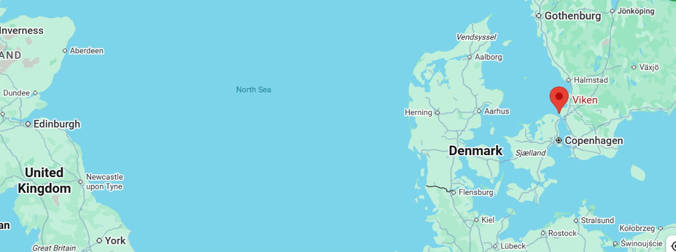
Modern internet map of the North Sea with the UK to left (west) and Denmark and Sweden to right (east)
Google map centred on Viken, Jolani‘s homeport until 1897, depicting the intended voyage from Gothenburg (upper right) to Newcastle-upon-Tyne (lower left)

Rescue at Goswick Bay

The Holy Island lifeboat crew were alerted to the disaster and hauled their lifeboat, Edward and Eliza, some 4½ miles across the sands towards Goswick using six horses. Conditions remained extremely difficult, with rescuers wading waist-deep through the swollen channel known as the Gut before launching into the foaming surf. (For more on horse-powered RNLI launches, see this RNLI article.)

Repeated attempts to reach the wreck failed as darkness, heavy seas, and powerful surf drove the lifeboat back towards shore. Nevertheless, the rescuers persisted through the night. Eventually, ropes and lifebelts enabled contact with the wreck, and all fourteen crew members were brought safely ashore during the early hours of the morning. Contemporary descriptions vividly portray the disintegration of the vessel, with masts collapsing and gradually breaking up as rough seas crashed over the hull.

An account published in a Swedish newspaper in 1956 equally vividly described the conditions aboard (translated from Swedish):

The river rose, so that no one could get ashore. It was a difficult time for the 14 people on board. Huge rough seas constantly crashed over the ship. The fore and main masts snapped and went overboard. The planks were literally torn away from the hull, and the stern was torn off just before the cabin. The mizzen rig remained standing, however, and those on board clung to it, while the ship was gradually ground to coffee grounds in the cauldron of rough seas. It was not until nightfall that the coast guard, with the help of rocket launchers, was able to get out its lines and rescue everyone on board. (Kristiansbladet, Thursday 5 January 1956, p11)

Members of the lifeboat crew were later recognised by the Royal National Lifeboat Institution for their actions during the rescue and the Jolani is a good example of a wreck lost during wartime that was not lost to war causes.

Artefacts and Legacy

Today, much of Jolani’s history survives through the collections of Viken’s Maritime Museum. Preserved artefacts include four original logbooks, photographs, literature, a silver leaf artwork from Cape Town depicting the vessel, and an armchair from the captain’s cabin donated by descendants of the Lilja family, as well as paintings by Allan Fröjd, T. G. Purvis, and Christer Hägg.

Open wooden sea chest with a portrait of the ship Jolani painted inside the lid in a half-moon set against a painted orange background, and inside the body of the chest three closed dark wood compartments
Hand-painted sea chest belonging to Jolani’s last captain. © Vikens Sjöfartsmuseum (Viken Maritime Museum), Sweden, June 2026

Interest in Jolani continues today through ongoing research and public engagement. This blog is published to coincide with a presentation at the Viken Maritime Museum on 26 July 2026 by marine artist and former captain in the Royal Swedish Navy, Christer Hägg exploring the history of the vessel alongside two newly completed paintings inspired by Jolani and her long maritime career, and celebrates the international connections that make research into our wrecks possible.

With many thanks to Vikens Sjöfartsmuseum and Christer Hägg for their very kind help and an interesting collaboration and exchange of ideas: for our part, we were able to provide more details on the vessel’s fate and contextualise her type by reference to other vessels of the period wrecked in our waters. And, of course, once again many thanks to Tanja for writing this blog!

References

Illustrated Berwick Journal, “Details of Wrecked Vessels”, Thursday 23 November 1916, p. 5

Kristianstadsbladet, “Julseglats med kungaskeppet Jolani”, by Orvar Nilsson, Thursday 5 January 1956, p. 11

Lloyd’s List, Friday 24 November 1916, p. 7

Liverpool Journal of Commerce, https://www.wrecksite.eu/wreck.aspx?206803, accessed 2 June 2026 

South Wales Daily News, Friday 24 November 1916, p.6 Top of Form

The Times, “Casualty reports”, 24 November 1916, p. 14

Vikens Sjöfartsmuseum, https://vikensbyaforening.se/fartygshistorik/, accessed 2 June 2026 [in Swedish]

Email correspondence with Vikens Sjöfartsmuseum and Christer Hägg, June 2026.

A ship with three identities: the Mexico disaster, 1886

We are delighted to welcome as our guest blogger this week Roger Burns, who has researched and written this post. Roger describes himself as a ‘retired civil engineer, who, seeking a hobby, volunteered in 2016 with the Maritime Archaeology Trust, for whom he researches wrecks and drafts articles and blogs, and as a result has become a regular contributor of wreck data to Historic England. Prior to volunteering, Roger had minimal maritime knowledge, but is now fully immersed in such an interesting and rewarding pursuit.’

On the anniversary of the final loss on 27th February 1900, Roger tells the story of a ‘wrecked’ vessel which resulted in a horrific tragedy off the Lancashire coast – one ship, three identities, and two distinct fates, with no apparent connection between the two events until his recent research.

Contemporary oil painting of the hull of a wreck under a dark cloudy sky at low tide, allowing salvors to attend the wreck (on the left).

Figure 1: The wreck of the Mexico, Emil Axel Krause, 1886. As a Lancashire painter born in Germany, the wreck of the Mexico must have held double appeal as a subject.
Source: https://artuk.org/discover/artworks/the-wreck-of-the-mexico-66088
Atkinson Art Gallery Collection CC BY-NC-SA

Early career: as the John Bull

We begin with the launch of a barque on 21 February 1860 as the John Bull by Thomas R. Oswald & Co., Pallion, Sunderland for Temperley & Co., White Lion Court, Cornhill, London, a modestly-sized 3-masted sailing vessel of 484 tons gross. (1) Completed in March 1860, it was registered at London as ON28377 of 484 tons gross. With a single bulkhead, the vessel was constructed (2) throughout of iron protected by red lead paint, except for the deck which was yellow pine, provided with one longboat and two other small boats, certified and classed 12A1 by Lloyd’s.

We are able to trace the story of the John Bull in the British Newspaper Archive and elsewhere. The ship was intended for the London to Quebec and Montreal trade, first arriving on 17 May 1860 and these return voyages endured until November 1872, encountering seasonal ice. Exceptions were a return passage in 1866 to Woosung and Shanghai, another when in December 1872, the John Bull departed London for New Zealand, returning to London the following November, then departed again for New Zealand returning via Australia destined for Leith. The 1872 voyage to New Zealand provides exceptional detail in both British and New Zealand newspapers: over May and June 1873 there were several newspaper Notices of Auctions for three bales of curled horse hair, 79 kegs of crushed loaf sugar, 10 packages of Eleme raisins, one bale of bleached cotton waste, two bales of grey blankets, and an assortment of tin boxes of tin plates, all of which had been landed by the John Bull “more or less damaged by sea-water”. An out-of-character destination in November 1876 when en route London to Montreal was Guadeloupe, either as a diversion, or due to storms. The last Canadian trip appears to be mid-1878 and then, on 28 December 1878, when en route from Baltimore to North Shields with a cargo of Indian corn (maize), the ship’s boy, who hailed from London, fell overboard in heavy weather and drowned.

There were several changes of ownership, with the John Bull being regularly advertised for sale between November 1879 and March 1881. During this time, it had been dry-docked, chipped and painted internally and externally and provided with new main mast, main and foretopsail yard, jibboom and windlass. Contained in a Lloyd’s dated 19 May 1881, was another change of ownership to Gebrüder Oetling of Hamburg, including the construction of a ‘house’, 6.55m long, 4.15m wide and 1.96m high, on the deck between foremast and main hatch – unfortunately, records do not show details of previous accommodation. (3)

A change of name: Mexico

At this point it was also renamed the Mexico, re-registered at Hamburg, and a Captain Burmeister assumed command, signalling a change in routes through until summer 1886. Reported ports of call included, in chronological order, Santos, Valparaiso, Iquique, Hamburg, Arica, Corinto, Liverpool, Marseilles, Hamburg, Pauillac, unidentified ports in Central America, Hamburg, La Union, La Libertad, Tebuantepac and Liverpool. Between September and November 1886, regular advertisements appeared for repeat sailings between Liverpool and Guayaquil, Ecuador.  

Between 1860 and 1881, there were 18 Lloyd’s reports, of which eight were regular Annual Surveys, the remainder including repairs, mostly of checking and repainting the hull, always retaining its original classification, thus supporting its ‘For Sale’ advertisements which drew attention to its pedigree.

The first wreck as Mexico, 1886

Media reports of the wrecking of the sailing barque Mexico appeared in the newspapers of 10 December 1886, notably the local Lancashire Evening Post, intimating that the vessel had gone aground just off Southport, was dismasted, and its 12 crew were saved, but also that disaster had struck two RNLI lifeboats, from Southport and St. Annes, with 27 of 29 of their crews drowned. (4)

Map of the Ribble Estuary, showing the location of the wreck west of Southport, with St. Annes and Lytham to the north; inset map at top left showing the location on the north English coast.

Figure 2: Location of the first wrecking of the SV Mexico, and the three involved communities
(Maritime Archaeology Trust)

The Mexico had departed Liverpool the previous night with a general but valuable cargo for Guayaquil, Ecuador but managed only some 15 miles, encountering atrocious weather. The Southport lifeboat, the Eliza Fernley (5) was launched first, but capsized and was swept ashore, with only two of the 16 crew surviving. The St. Annes lifeboat, the Laura Janet (6) was also launched but it too capsized with all 13 crew being lost. The Lytham lifeboat, Charles Biggs, was launched for its maiden rescue, and succeeded in bringing all 12 crew of the grounded Mexico safely ashore. The loss of 27 RNLI volunteer crew remains to this day as its worst crew death toll in its long and distinguished history.

The newspapers were awash with reports for days afterwards. It is salutary to read the experience of John Jackson, one of the two survivors from the Eliza Fernley, who had been a volunteer lifeboatman for 15 years, transcribed from the 10 December 1886 issue of the Lancashire Evening Post:

‘At ten minutes to ten (pm) the horses set off with the boat, and, after experiencing considerable difficulty, launched the boat at eleven o’clock. A large crowd saw us off and the excitement was tremendous. The boat was launched successfully and went nicely for a time. A very heavy sea was running at the time, and our troubles soon commenced. Captain Hodge and Peters, the second coxswain, were at the helm, and as sea after sea washed over us, every man stuck grimly to his seat. We were beaten back several times and shipped an immense quantity of water. It was pitch dark at the time, and the only indication of the distressed barque was the faint glimpse of a lamp, which, as we got closer, we saw hung from the mizzen top. I was able to discern that the vessel had lost her foremast and mainmast. We were at length within 30 yards off the vessel, and could hear no shouting, indeed the storm rose to such a pitch that it was with difficulty that we could hear our own voices. I was just about letting go the anchor to get the boat alongside the vessel—we were then I should say, twenty yards from the barque—when a tremendous sea caught the boat right amidships, and she went over. We expected her to right herself, but she remained bottom upwards. Some of us managed, at length, to crawl out. I and Richard Robinson held firmly to the rowlocks, and was buffeted about considerably. With some difficulty I got underneath the boat again, and spoke, I think, to Hy. Robinson, Thos. Jackson, Timothy Rigby, and Peter Jackson. I called out, “I think she will never right; we have all to be drowned.” I heard a voice–I think it was Henry Robinson’s–say, “I think so, too.” I got out again and found Richard Robinson “fairly done.” He leaned heavily on my arm, and I think he must have been suffocated. Another heavy sea came, and when it receded, he had disappeared, and I never saw him again. While underneath, I called out to my brother “Clasper!” — that is a sort of nickname we gave him—but could get no answer. The boat eventually drifted bottom upwards to the shore, and those who were rescued, like myself, clung to her. I don’t know what became of the rest, I was exhausted. I remember seeing two or three struggling to reach the boat, but I do not know who they were. I drifted with the boat, bottom upwards, to the beach—and staggered home, about three o’clock in the morning.’

The RNLI have authored several reports, including this one on the centenary of the event in 1986.

The ensuing 2½ years

There was an outpouring of condolences from all walks of life, including Queen Victoria. The public relief fund, over an extended period, raised £35,000 (approx. £3.5m in 2022) to which the Emperor of Germany contributed £1,300. Just a few days after the disaster, the National Lifeboat Association announced that they would pay the cost of the funerals, held on 14 December 1886 and witnessed by huge crowds, and would also provide monetary assistance to the families until the public fundraising was complete: later, annuities from the relief fund were distributed to the families, sadly comprising 16 widows and 50 fatherless children. (7)

The St. Annes and Southport lifeboats were replaced in late 1886 with improved with improved water-ballast versions, but still powered by oar, and, weather permitting, sails. (8)

At a ceremony on 1 February 1887, the crew of the Charles Biggs were each thanked in person by Mr Babr, the German Consul, with a modest reward in appreciation of saving the Mexico’s German crew. (9)

On 11 March 1887, after three months partly under water, tugs towed the Mexico to Lytham where it was beached – Messrs Allsopp and Sons of Preston had secured the wreck for £70 in the expectation of reaping the rewards of its cargo, although a significant amount had been salvaged soon after the disaster and sold in local shops. During 1888, three obelisks and a memorial were erected in memory of the 27 lifeboat crew who were drowned.

Montage of four colour photographs of monuments in different styles; top left, obelisk; top right, chest tomb with broken mast feature; lower right, statue of lifeboatman on plinth; lower left, Gothic spire on plinth.

Figure 3: The four memorials, all listed structures, clockwise from top left: lifeboat monument, Southport; monument to the Southport lifeboat Eliza Fernley; lifeboat monument near St. Annes Pier; monument to the St. Annes lifeboat Laura Janet

It was right that the 1886 tragedy brought the RNLI into focus, precipitating the first public street collection in Britain in 1891, nearly seventy years after the RNLI’s inception in 1824.

The Mexico resurrected

A ‘For Sale’ advertisement in Lloyd’s List of 11 February 1889 offered the hull of the Mexico where it was lying on Lytham beach, with anchors, chains, steel hawser, some timber, ropes and a derrick, and with mizzenmast standing. Three months later, the Greenock Telegraph and Clyde Shipping Gazette of 14 May 1889, reported that the Mexico had arrived at the Old West Dock in Greenock for an expected two months of repairs by a Mr Thomson, boilermaker, in preparation for the West India trade. It must have been considered a worthwhile investment despite its wide-ranging voyages as John Bull, grounding off Southport as Mexico, enduring over two years of storms at Lytham, and then towed some 200 miles to Greenock, thus being a credit to the structural design and skill of the builders who specialised in iron ships from 1860 – regular survey by Lloyd’s and essential maintenance by the owners also contributed.

Final fate as the Valhalla

The new (managing) owner was Lewis T. Merrow, 65 West Regent St., Glasgow and the Mexico was re-registered with 477 tonnage at Glasgow until 1898. Ownership was then briefly held by J.P. Clausen, Nordby, Fanø, Denmark, who renamed the vessel Valhalla. The final owner was A/S Valhalla, managed by Hans Blom & Frithjof Ohlsen, Fredriksvaern, Norway. By now, it was registered in Fredriksvaern, with new number 1028377, and her tonnage recorded as 494 gross/476 net. The voyage history after repairs at Glasgow is sparse and lacking detail in the cargoes carried, but ports visited from the Clyde included the Demerara region of Guyana, Pensacola, and Belfast.

With nine crew and the master (whose name is either omitted from both British and Norwegian newspapers, or variously spelt as Servig, Sorvig, Sowig etc.) the Valhalla departed Gravesend for Grangemouth in ballast, and while off the North Berwick coast on 27 February 1900, encountered a rain storm, haze, and heavy sea, and ran aground opposite Tantallon Castle. (10)

Location map showing the wreck of the Valhalla off Tantallon Castle; inset map at top left showing the relative location near Edinburgh

Figure 4: Location of the final wreck SV Valhalla (Maritime Archaeology Trust)

The North Berwick lifeboat was called out, and like at Southport, four lifeboatmen were washed overboard but fortunately regained their lifeboat. The Valhalla’s crew were pulled ashore in their own boat, aided by a rocket line from shore, and, except for one injury, were safe and well. (11) The Valhalla was dashed to pieces, and the crew were repatriated.

Text in Norwegian (translated in caption) in Black Letter Gothic typeface from contemporary newspaper

Figure 5: Contemporary report in Norges Sjøfartstidende, 5 March 1900, p2 (excerpt).
Translated, this reads: ‘Valhalla. Dundee, 28th February. Norwegian barque Valhalla has now completely broken up.’
Source: Nasjonalbiblioteket, Oslo, Norway. CC-BY-NC-ND

We would like to express our appreciation to Roger for telling the fascinating story of the Mexico/Valhalla, a ship that was wrecked twice over in two different places, and also to Julie Satchell of the Maritime Archaeology Trust for her kind assistance.

The connection between the two events has until now been obscure, with the two years between the first wreck event involving the Mexico and its eventual recovery for sale highly unusual, to sail again as the Valhalla, and the different names under which the barque went ashore on those two occasions.

The double ‘loss’ of the same ship under different circumstances several years apart is also unusual: it is not unknown, but is a relatively rare event (one of the better-known examples being HMS Thetis, sunk in Liverpool Bay in 1939, which was salvaged and re-entered service as HMS Thunderbolt, only to be lost with all hands in the Mediterranean in 1943).

There are also more interesting features about this ship since it illustrates over the course of the two wreck events that, on the one hand, a shipwreck such as Mexico may entail loss of life (in this case of the lifeboatmen who went so gallantly to the rescue) but the ship itself is recovered; on the other, as Valhalla, the crew may be saved, but the vessel itself lost.


Footnotes:

(1) http://www.sunderlandships.com/view.php?year_built=&builder=&ref=105355&vessel=JOHN+BULL/

(2) Iron Ships Report for John Bull, 23rd February 1860 – https://hec.lrfoundation.org.uk/archive-library/documents/lrf-pun-iron434-0176-r

(3) Report of Survey for Repairs, &c for Mexico, 19th May 1881  https://hec.lrfoundation.org.uk/archive-library/documents/lrf-pun-lon665-0613-r

(4) Mexico; https://www.heritagegateway.org.uk/Gateway/Results_Single.aspx?uid=3ca4c738-ba17-4906-87cc-d5ec4943fe42&resourceID=19191

(5) ibid (Mexico); Eliza Fernley: https://www.heritagegateway.org.uk/Gateway/Results_Single.aspx?uid=2e1647cd-fc97-44ae-843b-692e41686884&resourceID=19191

(6) ibid; Laura Janet: https://www.heritagegateway.org.uk/Gateway/Results_Single.aspx?uid=fd3d560b-8ff7-4e25-99ba-c5240fb2e12f&resourceID=19191

(7) https://rnli.org/about-us/our-history/timeline/1886-southport-and-st-annes-lifeboats-disaster

(8) Leeds Mercury, 15 December 1886; https://lifeboatmagazinearchive.rnli.org/volume/13/143/the-life-boat-disasters-at-southport-and-st-annes?searchterm=fernley&YearFrom=1886&YearTo=1888&page=1

(9) Lancashire Evening Post – 1 February 1887

(10) https://canmore.org.uk/site/120022/valhalla-tantallon-castle-gin-head-firth-of-forth

(11) North British Daily Mail, 28 February 1900

No.75 Andromeda (Diary of the War No.7)

One hundred years ago, on 13 February 1915, the English steel barque Andromeda struck the rocks while inbound for Falmouth, en route to London, with 3,000 tons of grain from Oregon.

Her inclusion in the War Diary for this month illustrates the fact that while ships faced new threats from enemy action in time of war, they continued to be just as vulnerable as ever to environmental hazards. It could be said that wartime voyages were doubly hazardous. For the year 1915 there were some 59 recorded strandings on beaches, sandbanks, and rocks, or approximately one eighth of all wrecks recorded for that year. (1)

The Andromeda is a snapshot in time: in the early 20th century the barque became a specialist carrier of grain cargoes, and her manner of loss was linked to another aspect of seafaring heritage: for she was inbound to Falmouth ‘for orders’. In effect, when a vessel was loaded at her departure port, her master and crew did not necessarily where the final leg of the voyage would take them. It would only be in making landfall in England at Falmouth, with its noted anchorage, that crews would receive their ‘orders’ for their final destination.

When the Andromeda ‘spoke with’ an armed patrol vessel off the Isles of Scilly on 12 February messages were exchanged: the patrol vessel warned of U-boat activity in the Channel, while the Andromeda requested a message be sent to Falmouth requesting a pilot to take her in there.

The vessel got into difficulties off Falmouth as squally, stormy weather ensued and the master continued to wait, with reduced sail, for a pilot who failed to materialise. As so often, the loss of the Andromeda was the result of a chain of circumstances. To quote the Board of Trade Inquiry report into the loss:

‘his implicit reliance on the wireless message of the patrol officer, the warning as to submarines, his knowledge that pilotage was compulsory at Falmouth, his anticipation that the harbour was mined’ kept him waiting off Falmouth, exposing his vessel to difficulties on a lee shore onto which she could not but be driven ashore. (2)

Thus it was that while not a war loss, the Andromeda was wrecked through environmental hazards – the weather driving her onto local rocks – in circumstances shaped by the heightened fear of wartime conditions.

With many thanks to Mark Milburn, who has located the bow of the Andromeda off Killigerran Head, east of Falmouth, and researched her history, enabling us to update our records.

(1) Source: National Record of the Historic Environment (NRHE) database

(2) Board of Trade Wreck Report for Andromeda

No.60 Sombrero

Phosphate cargoes

This week we will have a look at wrecks from one of our most picturesquely-named departure points, revealing Britain’s connections with Sombrero or Hat Island in Anguilla, and taking a look at a typical 19th century cargo whose true nature is often hidden behind agrochemical euphemism – nitrates, phosphates, fertilizer.

The island once looked like a three-dimensional sombrero: vaguely hat-like in shape, it once also reared out of the sea like the crown and brim of a sombrero, until the crown was diminished by quarrying from the 1850s onwards. The reduction can already be seen in this contemporary print from the heyday of the Sombrero trade in 1865, depicting ships crowding round this little island of only 92 acres. It also shows the source of the island’s natural resources, the seabirds wheeling in the air whose accumulated guano provided rich phosphate fertiliser for farming.

As so often with wrecks of ships involved in a particular trade, our wrecks date from the zenith of Britain’s guano interests in Sombrero, very nearly contemporary with the print. Two barques illustrate what must have been a typical route, lost in the Bristol Channel, bound for Gloucester: the Caravan in Walton Bay in 1869, and the Cornwall, sunk following collision off Lundy in 1871. By 1890 the island was effectively ‘quarried out’: centuries of seabird ‘resources’ had been rapidly depleted and dispersed to fuel the needs of American farmers in the 1850s and British farmers thereafter.

We know of 30 wrecks laden with guano, which was normally sourced from bird cliffs and bat caves. I cannot resist telling you, however, that a couple of other wrecks lost in English waters homeward-bound from Islas Lobos de Afuera or Islas Lobos de Tierra off Peru would appear more likely to contain guano from a less common source: from seals.

No.36 The Charlwood and the Duke of Buccleuch

Through A Glass Darkly

Tomorrow (as at 2013) marks the 122nd anniversary of the wreck of the Charlwood, an English barque which was struck amidships and cut virtually in two to founder off the Eddystone while en route from Antwerp for Valparaiso, Chile, with what was described in contemporary sources as a ‘general cargo.’

In an age which was increasingly dominated by steam, iron barques such as the Charlwood were able to hold their own on an ultra long-distance route from Europe to the Pacific coast of Chile where Valparaiso lies, negotiating Cape Horn at the southernmost tip of South America. They had one great advantage over the steamers – no need to put in for bunker coal in vast, empty oceans. It might be thought that there would be access to coal at calling points en route on the Atlantic coasts of South America, but there was a difficulty getting coal from the hinterland of South America to the ports – this is put into context by the fact that 10 out of the 14 wrecks recorded as lost in English waters with the destination of Valparaiso had a cargo of coal from the coalfields of Durham, the Welsh valleys, or the Ruhr. Coal was generally a popular import from Europe for various South American ports in the 19th and early 20th centuries. [Indeed, the Zoodochos mentioned in Wreck of the Week 29 was exporting coal to Buenos Aires.]

No wonder, then, that the cargo of the Charlwood was described as ‘general’. Yet she is a popular dive and her cargo is regularly seen to comprise glassware, including numerous wine and sherry glasses and decanters – so much so that she rejoices in the alternative sobriquet of the ‘Glass Wreck’. Her cargo suggests a demand for prestige goods from Europe and an appropriate destination in a country now one of the world’s largest wine exporters.

She has an almost contemporary parallel: only two years previously, in 1889, the Duke of Buccleuch also sank after a collision amidships with a significant cargo of glass- and chinaware, again on a long-distance route from Antwerp, this time to Calcutta. The Times, reporting on the incident, revealed that her ‘general cargo’ included iron nails and hardware. She is unusual in that her cargo, bound for a key outpost of the British Empire, originated in a non-British port – although she was, of course, a British ship. It was not until 1953 – after Indian independence – that another wreck in English waters bound to Calcutta began her voyage outside Britain, and this time it was a Swedish vessel.

Wrecks such as these are tangible evidence of the ebb and flow of international trade throughout time.

On another note: Does anyone have any ‘information challenges’ they would like to send me for inclusion in a future WOTW? Keep them coming!