The Vicuna

Ice cold in Norfolk

This month I’m delighted to welcome my colleague Ken Hamilton, Listing Adviser, Listing Projects and Marine Team, Historic England. On the anniversary of the loss of the Vicuna, 136 years ago, he discusses what happened on 6-7 March 1883, and revisits the evidence for the remains on the beach.

Over to Ken:

Great Storms are more common that one might think – 1703 and 1987 come to mind, and they occur regularly in between. One particular Great Storm was on 6 March 1883, where force 9 and 10 winds heralded one of the coldest Marches in 300 years. The storm resulted in the loss of over 50 vessels and over 200 crew around the North Sea, mostly fishermen from Hull and the Netherlands.

One vessel affected was the Vicuna, a 330 ton barquentine bound for her home port of Hull with a cargo of ice. The ship had left Larvik on 23 February, and anchored within the entrance to the Humber on 5 March. The wind rose overnight, and the ship’s master, John Sawyer, ordered the dropping of a second anchor at 8am on 6 March. One of her anchor cables parted at 9am, so the ship requested a tug to tow her into Hull. Both tow rope and the remaining anchor cable parted, but she then ran aground on Sand Haile on the southern shoulder of the entrance to the Humber. She was towed off the sand bank, set sail and sailed east to clear the coast and ride out the storm at sea. The Vicuna rode out the night at sea, but struck the Woolpack Sand off the Norfolk coast in the middle of the afternoon on the 7th. They came off the Woolpack Sand, and Captain Sawyer decided to head for Brancaster, but was blown south onto the beach at Holme-next-the-Sea, running aground at 4.30pm. The Hunstanton lifeboat was launched, the crew were taken off at 7.30pm and landed at Hunstanton at 10pm on 7 March.

Map of the North Sea coast between the Humber and Norfolk, showing the 50 miles travelled by the Vicuna between 9am on 6 March and 3.30pm on 7 March, and the two sandbanks where she grounded en route.
Route of the Vicuna. Modern Ordnance Survey mapping. © Crown Copyright and database right 2019. All rights reserved. Ordnance Survey Licence number: 100024900. Marine mapping © British Crown and SeaZone Solutions Ltd., All rights reserved. Product licence number 102006.006 © Historic England

The Vicuna‘s departure from the Humber was reported in the Shipping and Mercantile Gazette as the schooner Vienna (a confusion continued into the 21st century, as the two words are difficult to distinguish in 136 year old newsprint even when digitised!). Harder to explain are three entries in Lloyd’s List for 9 March 1883, two for the Vicuna, of Hull, and one for the Vicuna of Bristol (? Hull). It is not clear why the third mention (which is clearly the same vessel) was assigned a different port of registry!

The Vicuna was carrying 500 tons of ice, a not uncommon cargo in the late 19th century. The international ice trade began in 1806, when Frederic Tudor began to export ice from the United States to Martinique, in the Caribbean. Tudor, known as the “Ice King”, made his fortune transporting ice from the United States to the Caribbean and India. In England, William Leftwich started to import ice from Norway in 1822, and the trade grew from there. While Tudor did start to export ice from the USA to England in 1844, Leftwich’s main competitor was Carlo Gatti, who began to import Norwegian ice in the 1850s. Despite the invention of ice-making machines and refrigerated ships by 1882, the ice trade continued to grow until 1900 and did not seriously begin to drop until 1915 when the German blockade of the North Sea made its transport difficult. The last import of ice to the UK from Scandinavia was in 1921.

Ice was cut from south Norwegian lakes in winter, transported to the coast and packed into ships. The journey to England was between 500 and 600 nautical miles, and took between 5 and 10 days, depending on the weather. During that time, the ice would start to melt, with an average loss of between 5 and 10% of the cargo (the ice was insulated, usually with sawdust, but not refrigerated). On arrival, the ice was unloaded into commercial ice houses and ice wells. William Leftwich leased a former private ice house in Park Crescent West (Scheduled: NHLE 1427239), and constructed another in 1829. Carlo Gatti stored and distributed ice from his ice wells in King’s Cross (constructed in 1862: part of the London Canal Museum). A number of commercial ice houses survive across the country, particularly in fishing ports, for example in Berwick (Listed Grade II: NHLE 1396572) and Great Yarmouth (NHLE 1096794). Hull’s ice house was converted to a Salvation Army citadel in the late 19th century, and demolished in the late 20th century (the location survives as Icehouse Road).

It is interesting to speculate about the fate of the Vicuna, and the role of her cargo in her wrecking. After parting tow, she stood out to sea, heading east, but her subsequent known route was mostly to the south, albeit at about 1.2 knots (suggesting she was hove to or had no sail set). By the time the ship approached the Norfolk coast, she had been out in the storm for 36 hours, and so the crew were likely to have become exhausted. At the same time, loss of cargo through melting increased the risk of the ice shifting and affecting the stability of the vessel.

Collapsed hull of wreck still retaining its 'boat shape', half in water to the right, on an extensive beach under a blue sky.
Wreck at Holme-next-the-Sea, Norfolk, known as the Vicuna, February 2019. Courtesy of Ken Hamilton.

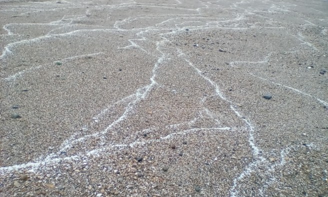
Following the wreck, the owners initially intended to refloat the vessel, but later offered to sell the ship and her fittings by auction, although it is worth noting that she was sold as a hull and not as a ‘wreck’. How much of this sale went ahead is not clear, as the remains on the beach do not entirely reflect the documentary evidence. The existence of the wreck was reported again in 1985, but was initially identified as an 18th century collier called the Carrington: the Carrington was, however, a 19th century collier, wrecked on 20 November 1893 on Titchwell beach, east of Holme-next-the-Sea.  Identification of the wreck (and its differentiation from other wrecks along Holme beach) was complicated by the beach itself – it is relatively featureless, so determining accurate locations on the beach was notoriously difficult until the wider availability of GPS systems.

A spread of Scandinavian stone used as ballast, together with oral history testimony, suggested that the wreck was the Vicuna. The spread of ballast was well known locally, and when the Holme-next-the-Sea timber circle (the so-called ‘Seahenge’) was found, the finder noticed it by picking up what he thought was a piece of ballast from the Vicuna that turned out to be a Bronze Age axe head!

Stones scattered over wreck timbers, largest stones in the centre left foreground.
Detail view of the wreck at Holme-next-the-Sea, February 2019. Courtesy of Ken Hamilton.

The writing of this blog has provided an opportunity to review this identification. The auction notice for the ship detailed 60 tons of iron ballast in the Vicuna as well as her 500 tons of ice cargo. An examination of the ballast on the wreck site shows it to be iron slag, and not Norwegian stone. The slag is interesting in itself – it is not blast furnace slag, but slag from a different process, possibly from a finery forge (the process of turning pig iron into wrought iron). Finery forges were replaced by puddling hearths in England in the late 18th century, but continued in use in Sweden until the development of the Bessemer furnace revolutionised steel production in the mid 19th century. If the slag from the wreck is finery slag, it would predate the construction of the Vicuna, and hence raises the possibility that the wreck is another ship entirely.

Lump of brown iron slag with cavities in it, with a scale rule to the right showing it to be 8cm high.
Detail view of iron slag as ballast from the wreck at Holme-next-the-Sea, with visible vesicles (cavities). Courtesy of Ken Hamilton.

There are few records of the nature of ballast on ships, but the existence of large quantities of slag suggests the ship came from an iron-working area. Coincidentally, British iron and steel production in the 18th century relied on Swedish iron, and two ships laden with Swedish iron ran aground between Hunstanton and Brancaster – the Christina, in 1763 and the Sophia Albertina (also identified as the Suffia Britannia Albertina) in 1764. Another, unnamed ship (also laden with iron) was mentioned as running aground the same week as the Christina. Given the lack of detail, the possibility that this third ship is a variant report of the Christina cannot be discounted. A further possible contender is the Hope, another Swedish ship which ran aground on the beach near Holme on 21 May 1771. Without more evidence (and analysis of the ship’s timbers) it is impossible to tell.

Many thanks to Ken for the above blog providing a fascinating new perspective on the Holme-next-the-Sea wreck, and all because he took a closer look at the ballast!

References:

Barraclough, KC ‘Steel in the Industrial Revolution’ in Day, J and Tylecote RF The Industrial Revolution in Metals (1991) The Institute of Metals pp261-306

Blain, BB Melting Markets: The Rise and Decline of the Anglo-Norwegian Ice Trade, 1850-1920 (2006) Working Papers of the Global Economic History Network (GEHN) no. 20/06

Lamb, H and Frydendahl, K Historic Storms of the North Sea, British Isles and Northwest Europe (1991) Cambridge University Press p143

Tylecote, RF ‘Iron in the Industrial Revolution’ in Day, J and Tylecote RF The Industrial Revolution in Metals (1991) The Institute of Metals pp200-260

Lloyds List, 9 March 1883 No. 21484, p11

Norfolk News, 17 March 1883, No.1995, p10

Shipping and Mercantile Gazette, 08 March 1883, No.14213, p4

Shipping and Mercantile Gazette, 09 March 1883, No.14214, p4

Shipping and Mercantile Gazette, 27 March 1883, No.14228, p6

National Slag Collection catalogue http://hist-met.org/nsc.pdf Accessed 1 March 2019

Norfolk HER entry for the Vicuna http://www.heritage.norfolk.gov.uk/record-details?mnf21961 Accessed 1 March 2019

Norfolk HER entry for wreck on Holme beach http://www.heritage.norfolk.gov.uk/record-details?mnf21962 Accessed 1 March 2019


The Acorn

The Acorn Part III: 2018

For our Christmas special, it’s my pleasure to welcome back Jordan Havell, now a regular guest blogger. I’m also delighted to let you know he received a ‘Highly Commended’ at the CBA awards, in the Young Archaeologist of the Year category.

He gives us an update on the Acorn, a barque in the ice trade, a suitably seasonal subject, which he first discussed in a blog for Christmas 2014, and recalls a dynamic year on the Lincolnshire coast.

Photograph of shipwreck timber seen from above, amid ridges and furrows in the sand with the tide flowing in and out.
Remains of the Acorn emerging from the sand, while marine life has been washed in, seen on 7 November 2018 © Jordan Havell

Jordan writes:

It is now 4 years since I wrote my first blog on the Acorn shipwreck.

Since then my family and I have watched as the wreck appears, disappears and reappears as a result of the tides causing the sand to shift. Photographs were taken each time the wreck was uncovered by the sea to be added to the national database.

Over the last year while doing this, we have noticed other archaeological finds, including a rather large piece of wreck washed up near Trusthorpe in May, and we were involved in recording and digitizing information on the wreck, including photogrammetry work. My mum and I found it after a local lady told us about it and we reported it to Historic England, Lincolnshire’s Finds Officer, Adam Daubney, and CITiZAN’s Andy Sherman for which I wrote a blog. A piece was taken for carbon dating. It is thought to be late 19th century/possibly early 20th. Merchants’ marks were recorded on this piece.

Other things found while doing various visits to the beach include: other ships’ timbers, possible aircraft fuselage pieces, copper sheathing from the hull of timber boats, large pieces of iron concretion, possibly from other local shipwrecks, worked flints, fossils, and Roman pottery. Parrel trucks and deadeyes from ships and even a possible sponge head from a cannon sponge were also among the objects found.

We have also seen much larger chunks of peat from the Lincolnshire Peat Shelf. These pieces have been much bigger than we have seen before. One day recently some of these large chunks were seen scattered right along the tideline for quite some distance.

Two fragments of dark brown peat, one large on left, smaller fragment to centre right, on sand
Fragments of peat washed up on 28 September 2018 © Jordan Havell

During March we saw the ‘Beast From the East’ affect our coastline. We saw hundreds upon thousands of stranded marine creatures, which was a shame to see. During this time we also saw many pieces of prehistoric forest timbers that we recorded and continue to do so.

Another day recently we saw salt lines across the beach – again, the first time we have seen something like this.

Shingle beach criss-crossed with white salt lines
Salt lines, Sutton-on-Sea beach, 2018. © Jordan Havell

I have attached some photos reflecting some of the above and of course some up-to-date pictures of the Acorn as she has recently given up more to see.

It’s amazing to see just how the tides have affected it over: over just a few days over the 21st to the 29th October 2018, the changes we could see were caused by shifting changes in the sand levels.

Acorn Oct 21 2018 1
The Acorn surrounded by water on 21 October 2018. © Jordan Havell

We took pictures on the 29th but couldn’t get as close due to the rising water levels around the wreck.

The Acorn 29th Oct 2018
The Acorn, 29 October 2018. © Jordan Havell

We will continue to monitor this wreck over the next few years in the hope that more starts to appear and I can then make another blog on it all to keep you up to date on it.

We’d like to thank Jordan for his detailed observations on the burial and exposure of this site over the last few years. It has turned into a fascinating case study on the processes and environmental context of wreck exposure in the inter-tidal zone on the east coast. It’s clear that the beach erosion revealing the Acorn and artefacts such as the Roman pottery (other Roman pottery was found locally in the 1950s) mirrors similar disturbances offshore, resulting in a variety of material being washed up.

We wish Jordan – and all our readers – a very happy festive season and all the best for 2019.


The Acorn

It is my pleasure to introduce my guest blogger for today’s piece, Jordan Havell, who wrote an article  on the Acorn back in December 2014. He takes up the story again with recent observations on changes in his local beach environment and the impact it has had on the Acorn.

***********************************************************************************

Since writing my last blog in December 2014 my interest in shipwreck archaeology has continued. Just recently I have found lots and lots of stranded wood being brought in on the tide from small pieces to much larger pieces. They may be pieces from a ‘billyboy’ called the Swan but that’s another story for later.

Fan shaped fragment of brown wood with holes in it, on a background of lighter-coloured brown sand with shells and pebbles
Example of one of the small fragments of wood and other debris recently washed up on the Lincolnshire coast following winter storms and high spring tides, photographed 19 February 2017 © Jordan Havell

Now here is where it gets more exciting . . . the Acorn . . .

The Acorn wreck was covered by literally tons of sand by the subsequent beach replenishment work over the last 3 years [since I last wrote]. Just recently however with high spring tides and Storms Doris and Ewan, the wreck has started to reappear.

I went to visit the beach like I normally do, but on the 16th of February 2017 I was very surprised to see that the sands had shifted heavily and the wreck was beginning to show again. Over the following days I visited this area nearly every day and each day more seemed to show.

Photograph of horizontal ship's timber against a backdrop of lighter-coloured sand.
Timber from the Acorn revealed 1 March 2017. © Jordan Havell
Detail photograph of brown fragment of ship's timber in the foreground, with lighter-coloured sand in the background.
Detail of a timber from the Acorn, photographed 1 March 2017. © Jordan Havell

I am looking forward to the illustrated talk and workshop in April with Andy Sherman from the Museum of London Archaeology CITiZAN Project in my village. I am really keen to hear about this work and how we can be even more involved.

I hope this gives you a snapshot of what is going on my locality. Thanks for reading!

*********************************************************************************

Thank you very much to Jordan for writing this piece and illustrating it with his own photographs – citizen science in action! As he hints, we will be hearing more from him, since his research has uncovered the interesting story of the Swan billyboy, which was also lost locally.

Newly Protected Wrecks in North Devon

The remains of two wooden wrecks on the sands in the Northam Burrows Area of Outstanding Natural Beauty have been scheduled as ancient monuments by the Department of Culture, Media and Sport.

Besides its natural beauty, the area is rich in maritime heritage, the sands lying off the entrance to the historic ports of Appledore, Barnstaple, and Bideford. The area also has strong literary connections. At the southern end of the sands lies Westward Ho!, named after Charles Kingsley’s 1855 novel, a tribute to the local Devon seamen of Francis Drake’s time. Westward Ho! attracted a school founded in 1874, the United Services College, immortalised by former pupil Rudyard Kipling in his novel Stalky and Co. (1899).

Often mentioned in Stalky and Co. is a distinctive pebble ridge at the land edge of the beach. It has been retreating landward for centuries and it is clear that no vessel could have breached the ridge in coming ashore, giving a clue to the age of the vessels by their distance from the ridge as it now lies today.

The two wrecks lie a few hundred metres apart from each other. It is not only the pebble ridge which has been eroded on this beach: as sand levels on the beach have risen and fallen, the wrecks have been repeatedly exposed and reburied, most recently during the winter storms of early 2014.

Let’s have a look at the smaller vessel first. It is the more northerly of the two, and can be seen to be constructed of timber and fastened with treenails (timber nails). It lies with one side exposed and the other buried underneath. This suggests that it either drove ashore on its beam ends in a storm, or came ashore and subsquently collapsed in its damaged state. It may even have been covered up very quickly if storm conditions deposited sand on the beach.

Stretch of sandy beach with a strip of water in the middle of the photograph, surrounding the timbers of a wreck protruding from the sand, set against a wide blue sky.
The smaller wreck on Northam Burrows Sands. Copyright Dr Roderick Bale (UWLAS) for Historic England

Because it is uncovered less frequently and for shorter periods than its ‘neighbour’ to the south, it soon became apparent that this wreck had been reported several times in slightly different positions. The research for the case enabled the true position to be established and the various different accounts to be reconciled.

Enough of the exposed side survives to suggest that it is probably the remains of a Severn trow lost around 200 years ago. From its very location on the Bristol Channel coast of north Devon, it is evidence of a period of transition for the Severn trow, during which it developed into a seagoing vessel working the Bristol Channel – a far cry from its original haunts of the River Severn as far inland as Shropshire.

The larger wreck, nearer to Westward Ho! is some 23 metres long by 7 metres wide and, when exposed, can be seen to lie on an even keel in the sand surrounded in its own ‘scour pit’ by water, which does not fully drain even at low tide. This allows an opportunity to observe on land a regular feature of underwater wrecks which displace sand as they settle into the seabed or move slightly in the sand with submarine tides and currents.

The almost complete outline of a wreck sitting in a pool of water against a backdrop of blue sky and clouds reflected in the water.
The newly protected Westward Ho! wreck on Northam Burrows Sands. It is believed to be the remains of the ‘Sally’, which ran aground on the sands in 1769, while bound from Oporto in Portugal to Bristol with a cargo of port wine. Copyright Devon County Council

This even keel was the first clue to the vessel’s possible identity, as was the fact that it lay stern on to the beach. Tree-ring sampling on a previous exposure in 2006 suggested that the vessel was built around 1750 to 1800. This gave a probable date range of around 1750 to 1830 for the date of loss, given the standard service life of around 25 to 30 years for most contemporary vessels. The visible treenails (timber fastenings) are consistent with this date range.

Walking the beach another clue appeared nearby in the sands with the exposure of more timbers, this time in parallel rows of posts suggesting a probable jetty or pier structure. This led us to conjecture that the vessel sank at anchor fairly close to this structure.

A sandy beach from which the tops of timber posts protrude in parallel rows, stretching out to sea. Breakers are on the shore against a grey-blue sky
Parallel rows of the exposed tops of posts suggesting the supports for some form of jetty structure. Copyright Historic England.

Looking at the records, there were two vessels out of the many recorded as lost in the area within this time frame that fitted the criteria:

The Sally, bound from Oporto to Bristol with wine and other cargoes including shumac (a plant dyestuff), came ashore in 1769. Recalling the incident afterwards in a sworn statement, her master stated that he ‘could have no command of the ship and that he imagined himself further to the eastward than he really was’. He let go two anchors one after the other but ‘she still driving, till at last she struck aft . . .’ (1)

The sloop Daniel, from Bristol to Cork with a general cargo, went ‘on shore on Northam Burrows; she brought up to an anchor, but unfortunately struck at low water and filled’ in 1829. (2) The local vicar and other worthies were among those who received a reward for ‘venturing in a tremendous surf in a life boat constructed by Mr Wm Plenty, which had never been tried before.’ (3) However, on further investigation, it transpired that the Daniel was only 4 years old when she went ashore (4), so, with a build date of 1825, she fell outside the date range revealed by the timber analysis.

This suggests that the Sally is the best match so far found for the vessel remains, ‘striking aft’ being consistent with the stern to the landward. She, too, provides evidence of change: she is a tangible reminder of the long-established wine trade between Britain and Portugal. The trade was centred on Bristol: from the Middle Ages onwards vessels laden with wine were a common sight in the Bristol Channel. At this time in the 18th century wine from Oporto was developing into the port wine that we know today with the addition of the fortification process. The Sally is therefore a reminder of an international trade at a key period in its evolution.

During the consultation process on these two wrecks more information came to light, including an article hitherto unknown to us, also proposing the Sally as the vessel at Westward Ho! (5)

The protection of these two wrecks led by Historic England was a real example of multi-agency collaboration in practice, sharing information to fully round out our knowledge of these two wrecks: among them, Natural England; Northam Burrows Country Park; Torridge District Council; United Kingdom Hydrographic Office; University of London; and University of Southampton Coastal and Offshore Archaeological Research Services (COARS).

Even Rudyard Kipling played a small part in the research by providing indirect evidence for the extent of the pebble ridge in Victorian times. The two wrecks are so old they would have been old in his time: a vessel described as ‘very old’ was revealed in the area in 1854, probably the larger vessel. As Kipling ran over the pebbles to bathe with his fellow schoolboys all those years ago, did he ever see the same two wrecks and wonder about them?

For more information on these wrecks, read the Devon’s Shipwrecks post on the Heritage Calling blog.

(1) affidavit of Benjamin Berry, master of the Sally, repr. in Farr, G. 1966. Wreck and Rescue in the Bristol Channel, Vol. 1, 44-5.

(2) Exeter Flying Post, No.3,337, 24 September 1829, p3

(3) North Devon Journal, Vol. VI, No.276, 8 October 1829, p4

(4) Lloyd’s Register, 1829, No.28(D)

(5) Hughes, B. 2007. ‘Attempting to name the large wreck on Westward Ho! beach’, North Devon Heritage, No.19, 8-12