Railways 200: a maritime perspective, Part Two

Full Steam Ahead: Tourism and Freight

In the second part of our three-part Railways 200 special we go full steam ahead . . .

If the railways and the steamship were virtually born together, they also grew up together. The railways not only facilitated the development of new ports and new markets: together they enabled both domestic and international travel for work, study and leisure. They opened up tourist travel, which percolated down the social classes as workers’ holidays began to gain traction with employers and the law – especially to the seaside, to ‘London-on-Sea’ at Southend and Brighton, and to other resorts. Nowhere was it easier to access the sea by rail than at the Kent resort of Ramsgate, decanting passengers straight onto the beach.

Historic B&W aerial photograph of Ramsgate Harbour Station, showing people walking straight from the station onto the beach; a park and genteel terraces in the town are shown in the upper register of the image
Ramsgate Harbour Station, 1920. Ramsgate Harbour Station was operational between 1863 and 1926.
EPW000093 Source: Historic England Archive

Isambard Kingdom Brunel and Bristol

Elsewhere passengers started their overseas journeys by rail. Trains provided connections with steamship and ferry services. Bristol is a city which became a transport hub – Isambard Kingdom Brunel’s transatlantic steamer and early ocean liner, the SS Great Western, entered service in 1838, followed by the SS Great Britain in 1845. (A liner is a vessel that provides a regular ocean-going passenger and/or cargo service between two or more fixed points, in this case Bristol and New York.) From 1841 the Great Western Railway (GWR) terminus at Bristol, also designed by Brunel, provided a connection for passengers to and from the liner, with a hotel also built for the convenience of passengers.

Modern colour photograph, Brunel's old station now beside a busy road with plenty of car traffic. The front elevation is built of cream limestone but areas behind, such as the side returns and chimney stacks, are built of less prestigious and darker Pennant stone.
Brunel’s Old Bristol Station, 2013 adjoining the present-day station. Its Tudor Revival style with its crenellations and oriel windows gives an impression of age and prestige
Peter Broster Wikimedia Commons CC-BY-2.0

In this case the connection was not entirely seamless, as passengers still had to traverse the city, and potentially stay overnight in the hotel, but it is a travel cityscape which sprang from the brain of one man – and one which is still legible in the city today with the Grade I-listed old station next to the present-day Temple Meads (itself built in the 1870s), Grade II-listed hotel (known today as Brunel House) and SS Great Britain in preservation in the city.

Modern colour photograph seen looking down from a nearby window over the SS Great Britain displayed in dock and 'dressed overall' with flags flying between her six masts. and the city beyond. The river is seen to left and foreground.
SS Great Britain in Bristol, 2025
© Anthony O’Neil, geograph.co.uk CC BY-SA 2.0

How many visitors to Bristol today alight from Temple Meads, with Brunel’s original station on their right, to see the SS Great Britain and realise that they are following in the footsteps (or perhaps train wheels!) of passengers making the original transatlantic connection?

The Port of Liverpool and the Great Western Railway

Another ‘nearly seamless’ integration between the railways and port infrastructure can be seen in the Great Western Railway warehouse and office on the dockside at Liverpool, dating from the late 19th century. The GWR did not actually reach Liverpool itself, but goods could be moved by barge between the GWR’s Morpeth Dock at Birkenhead [1] and their warehouse at Liverpool alongside the Manchester Dock (filled in: now underlying the Museum of Liverpool) – a reminder that the railways also joined up with canal and river traffic in many different locations.

Modern colour photograph of Liverpool: edge of dock in foreground with propeller to left and steam crane to right, with the black & white hull of the ship just beyond in the middle ground. The deck lies under the lower roof of the warehouse saying RAILWAY, while the upper structure lies beneath the upper roof structure of the warehouse with the words GREAT WESTERN RAILWAY, creating a visual echo in the composition, also echoed by the building works beyond, and the varied heights and sizes of the Port of Liverpool and Royal Liver Building domes at the top of the image.
In this 2009 photograph the Great Western Railway warehouse is sandwiched between dockside infrastructure and the museum ship Edmund Gardner on the one side and on the other the dome of the Port of Liverpool building, with the Royal Liver Building beyond – two of the iconic ‘Three Graces’ of Liverpool fronting the River Mersey.
DP073748 © Historic England Archive

The rise of passenger travel

As the great age of the steam liner expanded, so also did the railways, and the two fed off one another, not only in Britain, but in parallel developments in other countries in Europe and elsewhere. This in turn enabled mass tourism (Cook’s Tours from 1855 to Europe, for example), emigration, and its darker side, colonialism. The liners, linking with railways on both sides of the Atlantic, made it possible for Charles Dickens to connect with his audiences in the United States and for Frances Hodgson Burnett of Little Lord Fauntleroy fame to regularly criss-cross the Atlantic.

Historic B&W photograph of men, women and children posing beside a railway carriage to the left, steam rising against the roof of the station
Passengers waiting on the platform at Waterloo for the Cunard Steamship Company boat train, probably for Southampton, 1913. The photograph was commissioned by Cunard from Bedford Lemere, who also specialised in photographing newly-built liners.
BL22173/001 Source: Historic England Archive

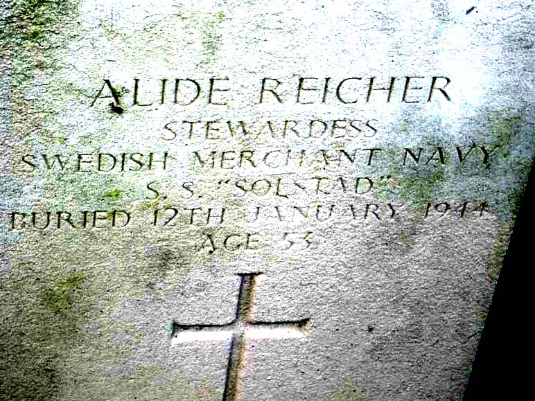
In the same way, liners grew not only to serve specific passenger routes such as Southampton or Liverpool to New York, or to serve European colonies abroad, but also to become cargo specialists. The late 19th and early 20th centuries saw the rise of cargo liners and of refrigeration, benefiting not only the growth of fish and chips (see Part One) but also enabling meat to be shipped from South America and Australia under refrigerated conditions, for example by the Nelson Line, and despatched onwards by rail. Our records mark the loss of the Nelson Line’s Highland Fling on Enys Rocks, Cornwall in 1907, and Highland Brigade, torpedoed off St. Catherine’s Point, 1918. [2]

Like the coal magnates of the north-east before them (as covered in Part One), the railway companies saw the potential in an integrated market and a seamless experience. They would run passenger trains to the ports: thence it was but a short step towards commissioning the building of steamers, operating ferry services in their own right, and providing onward travel.

Trains and ships in the Lake District

Sometimes the ‘onward travel’ was a new development in its own right and an extension of the leisure experience within Britain. The steam yacht Gondola, the idea inspired by Venetian travels, as well as her name and hull form, was commissioned by Sir James Ramsden of the Furness Railway Company and entered service from 1859. The Gondola allowed passengers alighting from the Furness line at Coniston to enjoy pleasure cruises on Coniston Water in the Lake District, enhancing their holiday experience. [3]

The links between railways and ships were especially close in the Lake District, because trains could also transport small ships like these: the Gondola‘s hull was transported in four sections by rail and heavy horse to Coniston to be assembled locally, a methodology also adopted for the motor vessel Teal on nearby Windermere in 1938. [4] The railway line to Coniston was closed in 1962 so the link between Gondola and the railway that once brought passengers to her has been broken. [5]

Modern colour photo of the Gondola on the lake against a background of green tree and heather-covered mountains
Steam yacht Gondola on a cruise on Coniston Water in 2011 © Ian Greig CC BY-SA 2.0

The growth of the ferry

Where the railways could most easily dovetail with the steamers and provide the most seamless experience was on what we would today call ‘short-haul’ routes and ferries across to Ireland, France, Belgium and the Netherlands. They built on existing ports and routes with a history of passenger demand. The experience could be completely seamless and was a strong selling point. ‘The train comes to a standstill bang opposite the boat’ at Southampton, as described in promotional literature for the Southern Railway in 1931. [6]

The wreck record illuminates how old some of these ferry or ‘passage’ routes could sometimes be. The Duke of York ‘passage boat’ struck the Goodwin Sands in 1791 en route from Dunkirk to Dover – perhaps even with some refugees from Revolutionary France? (Turner was ‘nearly swampt’ on landing at Calais in 1802 as his painting Calais Pier demonstrates.) In 1669 one of the regular packets between Harwich and Hellevoetsluis (the precursor of the Harwich-Hook of Holland service which still continues today), was wrecked at Dunwich.

Some railway + ferry services were run by prestige named trains, such as the Golden Arrow train of the Southern Railway, which linked with the Southern’s first-class ferry Canterbury at Dover, which in turn connected with the reciprocal Flèche d’Or train which took passengers from Calais to Paris.

Steam locomotive in green and black livery with a Golden Arrow on its side (to right of image) and the prominent Clan Line Merchant Navy Class logo, enclosing the line's house flag of a red lion rampant
The post-war Golden Arrow seen at the Railways 200 Greatest Gathering in Derby, August 2025, one of the Merchant Navy class, commemorating the Clan Line. © Andrew Wyngard

In general, the railway steamers had a fairly good safety record, but collisions in fog could and did happen, most notably with the Normandy paddle steamer, belonging to the London & South-Western Railway Company, which was involved in a collision off the Needles in 1870 with considerable loss of life while en route to the Channel Islands. [7]

Another collision in fog which ended more happily was that in the Channel between the London, Brighton & South Coast Railway steamer Seaford, having left Dieppe with passengers for Newhaven, and ‘le cargo-boat’ steamer Lyon, belonging to the French railway firm Compagnie des chemins de fer de l’Ouest, voyaging in the opposite direction under a reciprocal service arrangement. All on board the sinking Seaford were saved by the French ship, which returned to Newhaven, and ‘special trains’ were run for the passengers to get them home, although a few people were sent to hospital with broken legs and ankles. [8]

Vintage Southern Railway booklet cover featuring a map and promotional text for weekend and holiday travel to the continent, dated May 1st, 1939.
1939 Southern Railway brochure with map of connections, the last hurrah of passenger services before World War II. The Art Deco cover design blends stylised ships (white and pink) with steam trains (green) (Author’s own collection)

In 1918 the London & South-Western Railway ferry South Western was attacked by U-boat while on a cargo run from Southampton to St. Malo. More commonly, however, the railway ferries were lost outside both their normal roles and usual routes during both World Wars. They found themselves requisitioned for war service and were sometimes sunk on that service, such as the Southern Railway’s Tonbridge, which pivoted from her cross-Channel service to become a net layer (setting anti-submarine nets), and was sunk by a bomber off Sheringham in 1941.

Railway ferries also played their part both at Dunkirk in 1940 and during D-Day on 1944, including one very special class of ferry which we will take a look at next week in the conclusion to this blog series.

An artistic depiction of the steamship SS Canterbury with the Red Ensign flying astern, steam billowing from her funnels, and heading towards the White Cliffs of Dover
Southern Railway steamer SS Canterbury (of the Golden Arrow service described above) approaching Dover. Walter Thomas, c.1936 Science Museum Group Collection © The Board of Trustees of the Science Museum
A vintage black and white photograph of the ship in wartime livery, with an aeroplane flying overhead.
HMS Canterbury (FL 7489) Underway, at sea. As HMS Canterbury, the railway company ferry would participate in Dunkirk and D-Day
Copyright: © IWM. Original Source: http://www.iwm.org.uk/collections/item/object/205124826

All aboard for Part 3 next week . . .

With many thanks to Andrew Wyngard, railway consultant for this blog.

Logo celebrating 200 years of train travel since 1825, featuring the number '200' in stylized red design with a train track element.

Footnotes

[1] The Great Western Railway Warehouse and Office, Coastal and Intertidal Zone Archaeological Network (CITiZAN), online; photograph of the warehouse and office, CITiZAN, online

[2] Historic England NMHR records

[3] History of Steam Yacht Gondola, National Trust, online

[4] Gondola, National Historic Ships, online; Teal, National Historic Ships, online; MV Teal, Windermere Lake Cruises, online; ‘Lake Flotilla’, Liverpool Echo, No.17,595, 6 June 1936, p4

[5] Andrews, M and Holme, G, 2005 The Coniston Railway (Pinner: Cumbrian Railways Association)

[6] Leigh-Bennett, E P and Fougasse 1931 Southern Ways & Means (Plaistow: Southern Railway)

[7] Historic England NMHR records. It should be noted that the comment on the safety record pertains principally to records of losses within English waters, which are relatively few by comparison with the regularity of the service and the number of journeys undertaken; however, other wrecks did occur outside English waters, around the other home nations, the Channel Islands, and the coast of France.

[8] Historic England NMHR records; ‘A Channel Steamer Sunk: Loss of the Seaford‘, Morning Advertiser, 21 August 1895, No.32,535, p5; ‘Le Naufrage du Seaford’, La Marseillaise, p3 (in French)

[z] Railways 200 Fridays – PS Waverley, National Historic Ships, online

Diary of the Second World War – January 1944

The SS Solstad – a Swedish ship torpedoed in Convoy WP 457

It’s hardly attention-grabbing to summarise the facts of a ship’s loss in the headline title. But the more you look at it, the more there is in those bald facts that piques curiosity.

Wasn’t Sweden neutral in the Second World War? Why was a ship from a neutral nation torpedoed? (Neutrals were never immune to loss from war causes: often mines, which struck indiscriminately, but our records show that they were often torpedo targets, too.) What, in fact, was a ship from a neutral country doing in a British-led convoy wholly within British waters voyaging from one British port to another?

The Loss Event

The convoy prefix WP indicates Wales to Portsmouth. On 2 January 1944 the MV Underwood left Liverpool, arriving 3 January at Milford Haven. That day the MV Polperro sailed from Ellesmere Port for Milford Haven, arriving 4 January; at the same time the SS Solstad left Swansea for Milford Haven. On 5 January the assembled convoy finally put to sea from Milford Haven for Portsmouth with their escorts, including the destroyer HMS Mackay and the Isles-class naval trawler (i.e. a purpose-built Admiralty trawler, rather than a requisitioned fishing vessel) HMT Wallasea. [1]

Historic B&W photograph of ship seen in profile with painted blocks of colour breaking up the hull profile. A large plume of black steam issues from her funnel, as she makes her way under heavy clouds in the sky.
HMT Wallasea in dazzle camouflage underway in the Firth of Forth. (FL 9349)
Note that, as was common at this period, the prefixes HMS and HMT are interchangeably used, hence HMS on the original image caption, as shown.
Copyright: © IWM. Original Source: http://www.iwm.org.uk/collections/item/object/205120756

The convoy rounded Cape Cornwall and Land’s End and on 6 January 1944 seven E-boats (German Schnellboote, ‘fast boats’) of the German 5th Flotilla, divided into two flanks, under the command of Kapitänleutnant Karl Muller, were lying in wait to make a surprise attack from the landward. Just before 3am that morning, they opened fire. [2] At 5.25am the ‘resident naval officer at Penzance reported that a convoy had been attacked about five miles south of Treen coastguard hut’. [3] This suggests that the report had come from the coastguard at Treen. Twenty-five minutes later Penlee’s motor lifeboat W and S was on its way in a moderate south-westerly with a rough sea out into Mount’s Bay and on into the Channel. They found two rafts at the position stated, one with two men on it, and the other ten men and two women ‘survivors from the Swedish steamer Solstad, bound with coal from Swansea to London.’

The lifeboat picked them up, ‘made a further search, and found nothing’, radioing for medical assistance shoreside on arrival at 9am. She then ‘put out again and made a further search . . . found only wreckage . . . ‘

There was no sign of the convoy. They must have long swept past, with HMS Mackay having kept the 2nd group of E-boats at bay, while the E-boats themselves were on their way back to base at Brest.

Historic B&W photograph of guns mounted on a swivelling turret with a further gun mounted above on the deck of a ship in harbour. Across the sea in the distance are other ships dotted along the coastline.
Twin 6-pounder guns in HMS Mackay, August 1943, Harwich. (A 18739)
Copyright: © IWM. Original Source: http://www.iwm.org.uk/collections/item/object/205151459

S 136 and S 84 had sunk the Polperro, laden with coal, S 141 the Underwood, carrying ‘Government stores’ on ‘Special Military Service’, i.e. war matériel, S 143 the Solstad, again with coal (1780 tons), and S 138 their escort Wallasea. There was loss of life from all four vessels: Polperro was lost with all hands; at least 13 deaths are recorded from the Underwood; and, although not everyone died aboard the Wallasea, the toll was particularly heavy, with 35 lives lost. Aboard Solstad one of those who died was a stewardess, Alide Reicher; two of the crew who died were, however, British. [4]

A mystery of location

All four are charted wrecks, but, of the group, only Underwood appears to have been positively identified from her propeller boss, approximately 4 miles NW of a cluster of sites derived from the reporting position of of 49˚ 57’N 005˚ 28’W on all three merchants’ Shipping Movement Cards. This includes the Underwoods own card, so she at least is not at the position reported therein. [5] HMT Wallasea does not have a Shipping Movement Card, but has also been assigned to the ‘cluster’ position. The Shipping Movement position is likely to have been reported by others in the convoy – the Trade Division Signal for the convoy reported 16 ships, so a fairly large and well spread out convoy – and is likely to be an approximation or aggregate of reported positions from the escorts and/or commodore (lead merchant). [6]

The three charted reports of Polperro, Wallasea and Solstad, clustered around those Shipping Movement Card co-ordinates are all ‘dead’ or ‘disproved’, i.e. do not represent wreck sites but are based on contemporary records, not archaeological remains. In any case, they are clustered around an approximate position, which is also somewhat at odds with the other position quoted, that attended by the RNLI, which at 5 miles south of Treen would be approximately 49˚ 57’N 005˚ 37’W.

Modern location map of Mount's Bay, Cornwall, recreating the lifeboat's journey from Penlee, near Mousehole, and the three location pins as described.
Location map of the events of 6th January 1944, showing how the positions cited are at variance with one another: the lifeboat’s approximate voyage from Penlee to 5 miles south of Treen, where the Solstad was found, is shown. The yellow pin represents the known location of the Underwood, and the red pin the Shipping Movement Record cards’ approximate position for Polperro, Solstad and Underwood, and to which HMT Wallasea is also assigned. It has been proven inaccurate for Underwood, and in the light of the RNLI report, cannot be accurate for Solstad. 
The convoy direction was eastbound.

As we have observed in several of our previous blogs, it is not uncommon for wreck sites to be discovered some way from the location originally reported for all sorts of reasons, and in the case of a convoy the vessels would be dispersed over some distance. The position of Underwood is certainly 5 miles from Treen at approximately 49˚ 59’N 005˚ 31’W, but the bearing is SE of Treen, not south, and the ‘cluster’ location further away on a similar SE bearing.

When the RNLI first attended the wreck in the position given to them, 5 miles south of Treen, they found survivors from one ship, and when they returned they found wreckage, but it is not known how much of the wreckage was Solstad and which, if any, from the other ships – the RNLI report gives no further details. However, the discovery of Solstad‘s survivors suggests that the position reported to the RNLI was substantially correct, at least for that vessel. The lifeboat station at Penlee is on the western side of Mount’s Bay, and the lifeboat would have navigated southwards before rounding the coastline and bearing away to the south-west to intersect with the position given to them off Treen, with Underwood some 3 or 3.5 miles to the south-east as they moved out into the Channel, i.e. the identified position of Underwood now lies NE of the position to which they were bound.

The RNLI report does not mention any sighting of Underwood or any of the other vessels.

When they reached the scene to which they had been directed, they found only survivors from the Solstad; no other ships or survivors are reported (though there were survivors from Underwood and Wallasea, as well as Solstad, presumably picked up in convoy) so this does suggest that the other ships were, like Underwood, lost slightly outside both positions stated, i.e. the one given to the RNLI and the other reported on the Shipping Movement Cards. The loss of life, the fact that Solstad itself was not seen but rafts were, and the lack of any reported sighting of the other three by the lifeboat en route or at scene suggests that all four sank very quickly.

Modern colour photograph of wooden war memorial plaque with text picked out in gold, naming the men of the MV Polperro and the date of loss, mounted on the roughcast wall of a rural church.
Plaque to those killed in the MV Polperro, St. Wynwallow, Landewednack, Cornwall.
© George Pritchard (WMR-50769) https://www.iwm.org.uk/memorials/item/memorial/50769

Can we reconstruct the convoy and the relative positions of the ships? The E-boats attacked from the landward side. Underwood at least might well have been on the port and landward flank of the convoy. As Solstad was at the position reported to the RNLI, then she was astern and to the south-west of the known position of Underwood. It is hard to see how HMS Mackay held off further E-boat attack without being astern and to the west of the convoy, so close to Solstad, perhaps, and similarly Wallasea might have been the escort on the seaward flank.

Both the Merchant Shipping Movement Cards and the position off Treen reported to the RNLI either give or come out at the same latitude of approximately 49˚ 57’N, suggesting some accuracy at least to that half of the co-ordinates, potentially the starboard and seaward flank. It seems reasonable to suggest that the three unattributed wrecks in this convoy may therefore lie in an arc roughly bounded by the present position of Underwood to the north-east and the reported position of Solstad to the south-west.

The Solstad‘s loss report sheds no light on the matter, as it states ‘Sunk owing to war causes off South-West England about 6th January, 1944.’ [7]

Another mystery . . .

But to get back to the questions we asked at the start of the blog – what was Solstad doing there in the first place? Why is there a neutral Swede in a British convoy? The answer lies in Sweden’s statement of neutrality on the outbreak of the Second World War, and the measures then undertaken by the Allies and other neutrals in the early years of the war both in terms of trade and any agreements made with Germany, such as transit agreements for the occupation of Norway. For example, in early 1940, even before the entry of the United States into the war, President Roosevelt prevented the export of aircraft and engines to Sweden to prevent them falling into German hands, and Britain likewise blockaded Swedish transatlantic traffic. [8]

Relations between the Allies and Sweden were therefore somewhat strained, but in April 1940 Germany blockaded the Skagerrak, the sea between Denmark, Norway and Sweden, in tandem with the invasion of Denmark and Norway – at stroke depriving Sweden of nearly 600,000 tons of shipping which could no longer return to their home ports. It was an opportunity, therefore, for the Allies to procure much-needed shipping on time charter (i.e. being leased for a fixed period of time, rather than per voyage). Here was where commerce could improve relations and diplomatic outcomes. [9]

Map of Denmark, Sweden and Norway, centred around the shared sea of the Skagerrak. The blockade ensured that Germany controlled access to the North Sea, to the west of Denmark and Norway, and the Baltic Sea, to the east of Denmark and south of Sweden.
Location map of the Skagerrak: the German blockade prevented westbound access to the North Sea and eastbound access to the Baltic.
Creative Commons CC-BY-SA 3.0

The avenues open to the Allies for the ships of occupied nations did not apply in the case of neutral and unoccupied Sweden. However, commercial deals could be struck to mutual advantage: cash for Sweden, ships for Britain. Britain’s tonnage agreements with Scandinavian powers during the First World War were once more being played out in a different guise in this second conflict.

On 8 April 1940, Solstad‘s Shipping Movement card shows that she was in Burntisland, and therefore formed part of this group for which a commercial deal had been struck: although, unusually, her card shows all her movements from March 1939 onwards – before the war. Quite why has not yet been established, but it is a curious detail.

She was then allocated to the French on time charter to join a French convoy bound for the French Mediterranean port of Sète, and was ‘delivered at Methil’. After the fall of France in May 1940, Solstad was intended to return to the UK, but instead seems to have ended up in Casablanca in neutral Morocco, at that time a French colony under the control of the Vichy government. Thence she made her way to Barcelona, where her French time charter was transferred to Britain’s Ministry of War Transport (MOWT) from 20 July 1940.

Thereafter she worked UK to Spain and Portugal, both of which were also neutral, albeit under Fascist regimes: trade remained possible, albeit overshadowed by war. An Allied oil embargo aimed to prevent Spain joining the war on the Axis side, while Portugal preserved the ancient Anglo-Portuguese alliance and relations with Spain by remaining neutral without ever formally declaring neutrality. [10]

During this period of operations Solstad was sub-contracted to Welsh coal firms for iron pyrites. [11] Anglo-Iberian trade in the Second World War is not readily legible in archaeological remains in English waters, except for a handful of wrecks from the early years of the war. This history remains somewhat obscure from both the archaeological and documentary points of view, so there is little comparable context for the Solstad‘s early wartime history under MOWT. We can, however, say with certainty that the archaeological and documentary record reveals no Portuguese or Spanish wrecks in English waters during the war – unlike the pre- and post-war periods. [12]

For ships in convoy calls to other ports elsewhere on the Iberian peninsula were slated as to or from Gibraltar, somewhat obscuring their movements and trade. It is only by looking at the cargoes or the intended calling points if reported in convoy, and the Shipping Movement Cards, that slowly reveal the picture. In that regard, the convoys for HG 41 (Homeward – Gibraltar) of August 1940 and OG 73 (Outbound – Gibraltar), August-September 1941, in both of which Solstad participated, display more of the extent of the trade than the remains in English waters demonstrate. [13]

This is fairly unusual, as the numbers of wrecks for a given period and trade are usually reasonably proportionate to, or correspond well chronologically with, the ebbs and flows of that trade. [14]

Quite a few Swedish ships participated in these voyages – whether this is coincidental, as British-owned ships also made these voyages, or whether neutral ship to neutral nation voyages could facilitate matters, is an interesting question.

We know that while on time charter to the MOWT, the vessel continued in Swedish ownership and management – her Shipping Movement Card makes her nationality clear, supported by a survey report in December 1943, and her casualty report only a few weeks later, revealing that she belonged to Rederi AB Solstad in Stockholm, and the Swedish name of the company manager. [15]

After her last voyage to Spain in September 1941 to pick up iron pyrites, Solstad then made her way along the Spanish coast to join a 56-strong convoy of merchants with their escorts out of Gibraltar, departing on 2 October 1941.

She was then reassigned once more to British coastal convoys, and it was after just over two years of such duties, wholly within British waters, that she was finally sunk in January 1944.

Accounts of the loss event from several German-language sources based on primary material transcribed from E-boat logs, bring out another intriguing detail. They state that the Solstad was niederländisch or Dutch, but also state that the British Polperro was Swedish. [16] It is unclear whether there was a Dutch ship in the convoy – there may well have been, as many Dutch ships escaped, were transferred to the MOWT, and operated in British convoys – but we do not know all the ships involved in WP 457. Were nationalities simply swapped around in error at the time – which seems likely if Swedish nationality was attributed to a British vessel – or is there something more substantial behind this?

Solstad‘s history is thus peppered with slightly unusual details. It is a history which bears witness to the dance of the nations in time of war: a complex web of commerce, diplomacy, and warfare, which affected the ship’s operations and culminated in her loss.

Footnotes

[1] Registry of Shipping and Seamen: War of 1939-45: Merchant Shipping Movement Cards BT 389/42/240 Solstad (The National Archives, Kew) Catalogue entry; convoyweb

[2] Knifton, J 2015 “A very cunning Kapitän’, johnknifton.com, published online; Förderverein Museums-Schnellboot e.V. nd S-Boote in der Kriegsmarine 1935-1945: Die Kriegschauplätze der S-Boote: Englischer Kanal 1944 (in German) Förderverein Museums-Schnellboot e.V. published online

[3] RNLI, 1944 “Services by the Life-boats of the Institution, by Shore-boats and by Auxiliary Rescue-boats during 1944”, Lifeboat Magazine (RNLI: republished online)

[4] Knifton 2015; Merchant Shipping Movement Cards, Underwood, BT 389/31/3 (The National Archives, Kew); Commonwealth War Graves Commission records https://www.cwgc.org/

[5] United Kingdom Hydrographic Office: Underwood, UKHO No.22680; Polperro, UKHO No.22553; Solstad, UKHO No.22529; and HMT Wallasea, UKHO No.22549; Merchant Shipping Movement Cards, Polperro, BT 389/24/23; Solstad, BT 389/42/240, and Underwood, BT 389/31/3 (The National Archives, Kew)

[6] Convoyweb

[7] Lloyd’s Register Foundation Report of Total Loss, Casualty, &c. No.33528, January 1944, LRF-PUN-W217-0080-R

[8] Montgomery, V 1985 The Dynamics of British Policy towards Sweden, 1942-1945 (King’s College London: PhD thesis, online at the King’s Research Portal https://kclpure.kcl.ac.uk/portal/; Olsson, U 1977 The Creation of a Modern Arms Industry, 1939-1974 (Gothenburg: Institute of Economic History, Gothenburg University); Committee on Military Affairs, 1945 Elimination of German Resources for War, Hearings before a Subcommittee on Military Affairs, United States Senate, Part 5: Testimony of Treasury Department: July 2, 1945 (Washington: United States Government Printing Office)

[9] Montgomery 1985; Lottaz P and Ottosson I, with Edström, B 2022 Sweden, Japan and the Long Second World War 1931-1945 (London: Routledge)

[10] Rockoff, H & Caruana, L 2000 A Wolfram in Sheep’s Clothing: Economic Warfare in Spain and Portugal, 1940-1944, Working Paper, No.2000-08 (Rutgers University, Department of Economics, New Brunswick, NJ) doi: http://hdl.handle.net/10419/94297; Leite, J da Costa 1998 “Neutrality by Agreement: Portugal and the British Alliance in World War II” American University Law Review, Vol. 14, No.1 (1998): 185-199 Digital Commons; Trowbridge, B 2016 “History’s Unparalleled Alliance: the Anglo-Portuguese Treaty of Windsor, 9th May 1386”, gov.uk blog published online. There is other evidence of Portuguese help, or at least friendly neutrality, during the war: for example, Convoy OG 91 [Outbound – Gibraltar] in 1941 took refuge at Lisbon following an attack in the Atlantic.

[11] Registry of Shipping and Seamen: War of 1939-45: Merchant Shipping Movement Cards BT 389/42/240 Solstad (The National Archives, Kew)

[12] Source: Historic England wreck records

[13] Convoyweb: HG 41 and OG73

[14] Source: Historic England wreck records

[15] Lloyd’s Register Foundation, Report of Survey for Repairs &c. No.54854, Solstad, December 1943, LRF-PUN-W217-0082-R; Report of Total Loss, Casualty, &c. No.33528, January 1944, LRF-PUN-W217-0080-R

[16] Dutch nationality attributed to Solstad in Chronik des Seekrieges 1939-1945 Januar 1944 (Württembergische Landesbibliothek: published online) (in German) and Lebenslauf S-143 (Historisches Marinearchiv; published online) (in German); although Förderverein Museums-Schnellboot e.V. (published online: in German) correctly attributes Swedish nationality to the Solstad.

No.47 The Carl

With the effects of the storms still with us, I have recently been processing quite a number of reports of shipwrecks uncovered by recent storm activity. The latest is the SV Carl, a German ship said to have been wrecked in Booby’s Bay within Constantine Bay, north Cornwall in 1917.

Images of the archaeological remains are stunning and certainly show the lower ribs and plates of a steel-hulled vessel which clearly stranded in this location in the inter-tidal zone (thus certainly not “sunk”!) As the sand cover has been scoured away, the wreckage has been exposed to a greater extent than recently. She was first charted by the Hydrographic Office in 2007.

An extensive gallery appears here: http://www.dailymail.co.uk/news/article-2567490/First-World-War-German-shipwreck-uncovered-storms-remote-Cornish-bay-century-sank-towed-Royal-Navy.html?ITO=1490&ns_mchannel=rss&ns_campaign=1490

But – and there’s always a ‘but’ – the history of the vessel herself is difficult to establish. If she is the SV Carl, she was impounded at the start of the First World War in Cardiff as an alien vessel. She then entered Admiralty ownership. Three years later, while under tow to be broken up in London, she struck the Cornish coast; when they attempted to re-attach the tow she simply broke her back.

This information comes from the Daily Mail report, which cites a letter to the local press  in 1966, from a gentleman citing his mother’s eyewitness testimony, thus within living, or recent, memory in 1966. An anecdote about a ‘wrecker’ coming face to face with the coastguard as published in Cornish Shipwrecks, Vol.2, Clive Carter, 1970, suggests that this also came via the oral history route as repetition of a contemporary rumour that she had been captured at sea involved in clandestine minelaying.

This last illustrates how secondary sources can break the chain of evidence connecting a wreck event to the site. The Carl has so far proved very elusive although her builder and date of build are said to be as follows: Ritson of Maryport, 1893. She did not appear in the Times reports of the Prize Courts in 1914, while from fairly early on in the war British newspapers were subject to censorship on shipping losses (as were American newspapers from 1917). As she was neither British, Allied, nor neutral, nor was she lost to war causes, she falls outside the scope of Lloyd’s War Losses for 1914-18; as a sailing vessel she similarly falls outside von Munching’s list of Allied, Neutral and Central Losses for 1914-18.

What seems clear is there exists a photograph annotated “The wreck of the Carl of Hamburg, Constantine Bay” http://www.wrecksite.eu/imgBrowser.aspx?15265 (full view available to wrecksite subscribers) in handwriting consistent with that era, which is complemented by a similar photograph from a different angle further to the landward in the Mail photo gallery; however, both are undated.

A sailing vessel named Carl, built at Maryport in 1893 and in Admiralty ownership, appeared in the Mercantile Navy List in 1920, and her register was closed in 1923. So what, exactly, is going on here? How can we fill in the gaps between 2007 and 1917? First-hand testimony from 1966 is a help, but it has come to us fourth-hand. Was this another ship? Do any local residents have any memories or remember stories from their forebears of the wreck event, or any subsequent sightings of the wreck? The identification as the Carl is clearly based on local knowledge, which tends by its very nature to be oral history, with all that implies for the potential for disappearance.

Can you help?

If she is indeed the Carl, then she may well prove to be another example of a ship lost while destined for the breakers: see also http://thewreckoftheweek.com/2013/06/28/28-a-tourist-attraction/

For another wreck which was revealed by storm damage last year, please see: http://heritagecalling.com/2013/08/13/uncovering-englands-shipwrecks/